
BEST DAY HIKES NEAR SEATTLE: TRAILS, DIFFICULTY & WHAT TO BRING
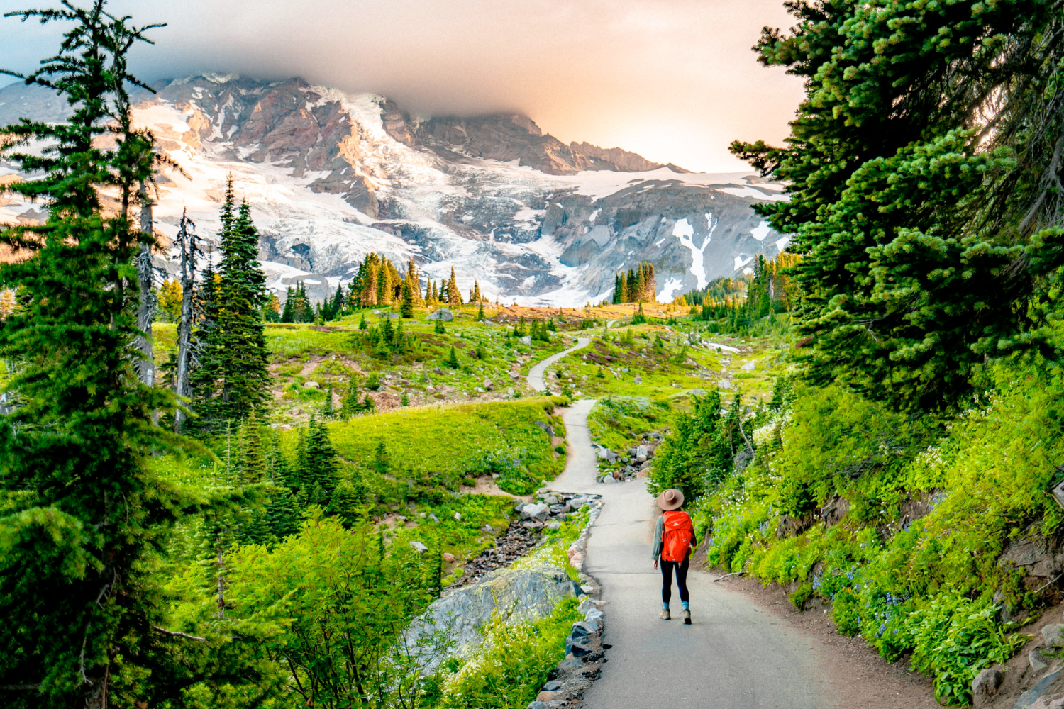
The Pacific Northwest is known for its incredible hiking opportunities, and the options for day hikes near Seattle are nearly endless. We’ve compiled some of the best hikes within a 2.5-hour drive of Seattle, along with short descriptions, difficulty levels, parking information, and a recommended list of what to bring.
Day Hiking Near Seattle
It’s no surprise that the Pacific Northwest is a hiker’s paradise. Vast expanses of evergreen forest, sharp peaks, snow-covered volcanoes, high-alpine lakes, thundering waterfalls, and winding rivers lend themselves to exploration by foot.
The hikes we’re covering here are all within roughly a 2.5-hour drive of Seattle, including a couple within Seattle city limits. Keep in mind that these hikes are only a small sampling of the trails within a few hours of Seattle—we couldn’t possibly list them all!
Apps to Help Choose and Plan Your Hike
Get more information about the hikes listed here—including directions to trailheads, recent trip reports, reviews, maps, and photos—through two popular hiking resources:
Downloading an offline map before heading out is also a good idea, particularly for trails where cell service may be limited.
Parking
Some trailheads offer free parking, while others require a Discover Pass, Northwest Forest Pass, National Park entrance fee, or another recreation pass.
Although some trailheads have payment kiosks, purchasing the appropriate pass online ahead of time is recommended. Always check current parking and pass requirements before leaving.
Getting There
While most of the day hikes on this list require a car, some may be accessible through Trailhead Direct, a seasonal weekend and holiday transit service that provides access from the Seattle area to popular hiking destinations along the I-90 corridor.
Check current routes and operating dates before planning your hike.
Issaquah Alps
Issaquah is a small city about 30 minutes east of Seattle. The Issaquah Alps are a group of forested foothills surrounding the area and include Tiger Mountain, Cougar Mountain, and Squak Mountain.
Poo Poo Point via Chirico Trail
A 3.8-mile out-and-back hike on Tiger Mountain, Poo Poo Point via the Chirico Trail climbs roughly 1,760 feet to popular paraglider launch sites.
At the top, you’ll be treated to panoramic views of Mount Rainier, Lake Sammamish, and the surrounding area. You might even get to see paragliders taking off.
Parking: Free parking at the trailhead
Difficulty: Moderate
Debbie’s View via Margaret’s Way
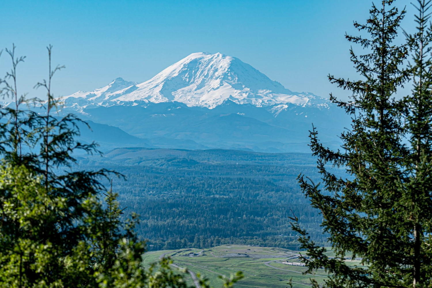
Located on Squak Mountain, Margaret’s Way is an out-and-back hike gaining roughly 1,600 feet in elevation.
You’ll walk through classic Pacific Northwest evergreen forest to Debbie’s View, where, on a clear day, you can see Mount Rainier to the south.
Parking: Free parking
Difficulty: Moderate
I-90 Corridor
Interstate 90 runs east out of downtown Seattle, across Lake Washington, and through Issaquah. Continue farther east and you’ll enter the Cascade foothills before eventually reaching Snoqualmie Pass, with hiking options becoming increasingly abundant along the way.
Mount Si
Located roughly 45 minutes east of Seattle near North Bend, Mount Si is a strenuous 8-mile round-trip hike gaining approximately 3,150 feet in elevation.
Mount Si is especially popular with locals for training hikes and summit views.
Parking: Discover Pass required at the trailhead
Difficulty: Moderately challenging
Rattlesnake Ledge
Before we go into details, rest assured there are no rattlesnakes in Western Washington! The name is commonly associated with a story dating back to the early 1900s, when rattling seed pods were mistaken for the sound of an agitated rattlesnake.
Rattlesnake Ledge is a popular 4-mile out-and-back hike about 40 minutes east of Seattle. The trail gains roughly 1,200 feet before reaching sweeping views over Rattlesnake Lake, the Cedar River Watershed, and the surrounding Cascade foothills.
Parking: Free parking at the trailhead
Difficulty: Moderate
Mailbox Peak
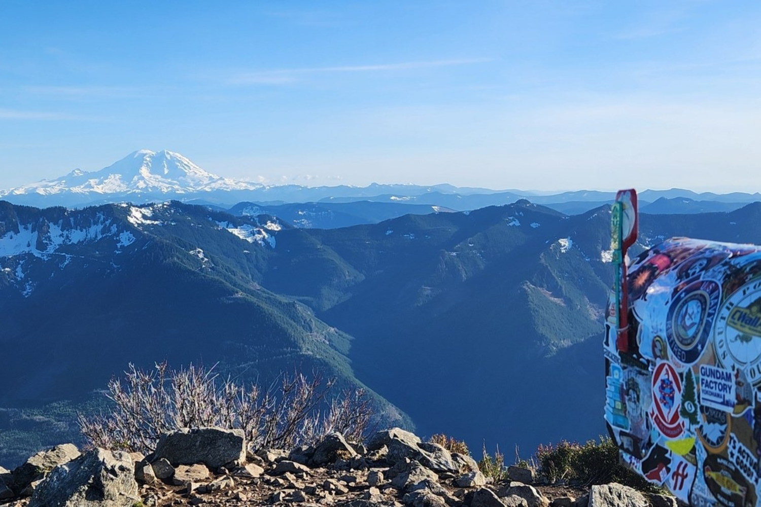
A formidable climb to the top of a lone peak in the Cascades, Mailbox Peak is commonly used by local hikers as a conditioning hike for more strenuous mountain objectives.
Reaching the top requires more than 4,000 feet of elevation gain. Hikers can choose the steep original trail or a longer, more gradual approach via the newer trail.
Once at the summit, you’ll be greeted by beautiful views of the surrounding Cascades along with the hike’s namesake: an old mailbox adorned with stickers and sometimes filled with items left by hikers.
Parking: Free but limited parking
Difficulty: Challenging
Franklin Falls
Located near Snoqualmie Pass, Franklin Falls is a family-friendly trail with approximately 400 feet of elevation gain across 2 miles.
You’ll walk through forest before reaching the beautiful 70-foot Franklin Falls.
Parking: Northwest Forest Pass may be required
Difficulty: Easy
North of Seattle
Mount Pilchuck
Hike to the summit of Mount Pilchuck, where you’ll find a historic fire lookout and expansive views of the surrounding Cascade Range.
On a clear day, views may include Mount Rainier, Mount Baker, and the Olympic Mountains to the west.
The trail gains roughly 2,300 feet over 2.7 miles. Be prepared for some scrambling and rock navigation near the top.
Difficulty: Moderately challenging
Wallace Falls
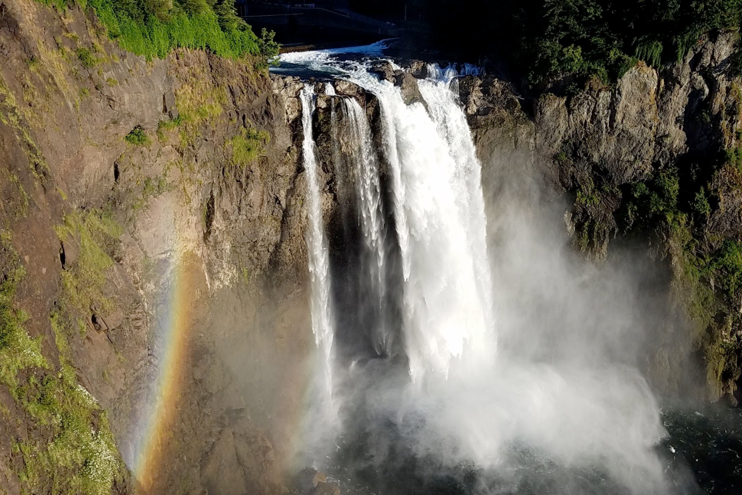
Located in Wallace Falls State Park about 50 miles northeast of Seattle, the Wallace Falls Trail meanders through forest and over small footbridges before reaching a series of waterfalls.
It’s a manageable 5.6-mile out-and-back trail gaining approximately 1,300 feet in elevation.
Difficulty: Moderate
Check current Washington State Parks parking and pass requirements before visiting.
Hiking at Mount Rainier National Park
The granddaddy of them all.
It would be impossible to list every hike inside Mount Rainier National Park, so below is a curated selection of several popular trails ranging from short walks to more challenging hikes.
Climbing to the summit of Mount Rainier is a highly technical and potentially dangerous endeavor that we won’t cover here.
If you’d rather experience Mount Rainier without planning the transportation and logistics yourself, Tours Northwest offers guided Mount Rainier tours from Seattle.
Naches Peak Loop
Located on the eastern edge of Mount Rainier National Park, Naches Peak Loop is a 3.4-mile loop with approximately 600 feet of elevation gain.
The trail offers views of Tipsoo Lake, seasonal wildflowers, and postcard-worthy views of Mount Rainier.
Difficulty: Easy to moderate
Skyline Trail
The Skyline Trail above Paradise delivers some of the park’s most impressive scenery.
Hikers can choose to hike a little or a lot. Taken as a full loop, the trail is approximately 5.6 miles with 1,800 feet of elevation gain.
For a shorter option, head toward Myrtle Falls for a waterfall view with Mount Rainier as the backdrop.
The Skyline Trail begins near the Paradise Visitor Center.
Difficulty: Easy to moderately challenging depending on the route
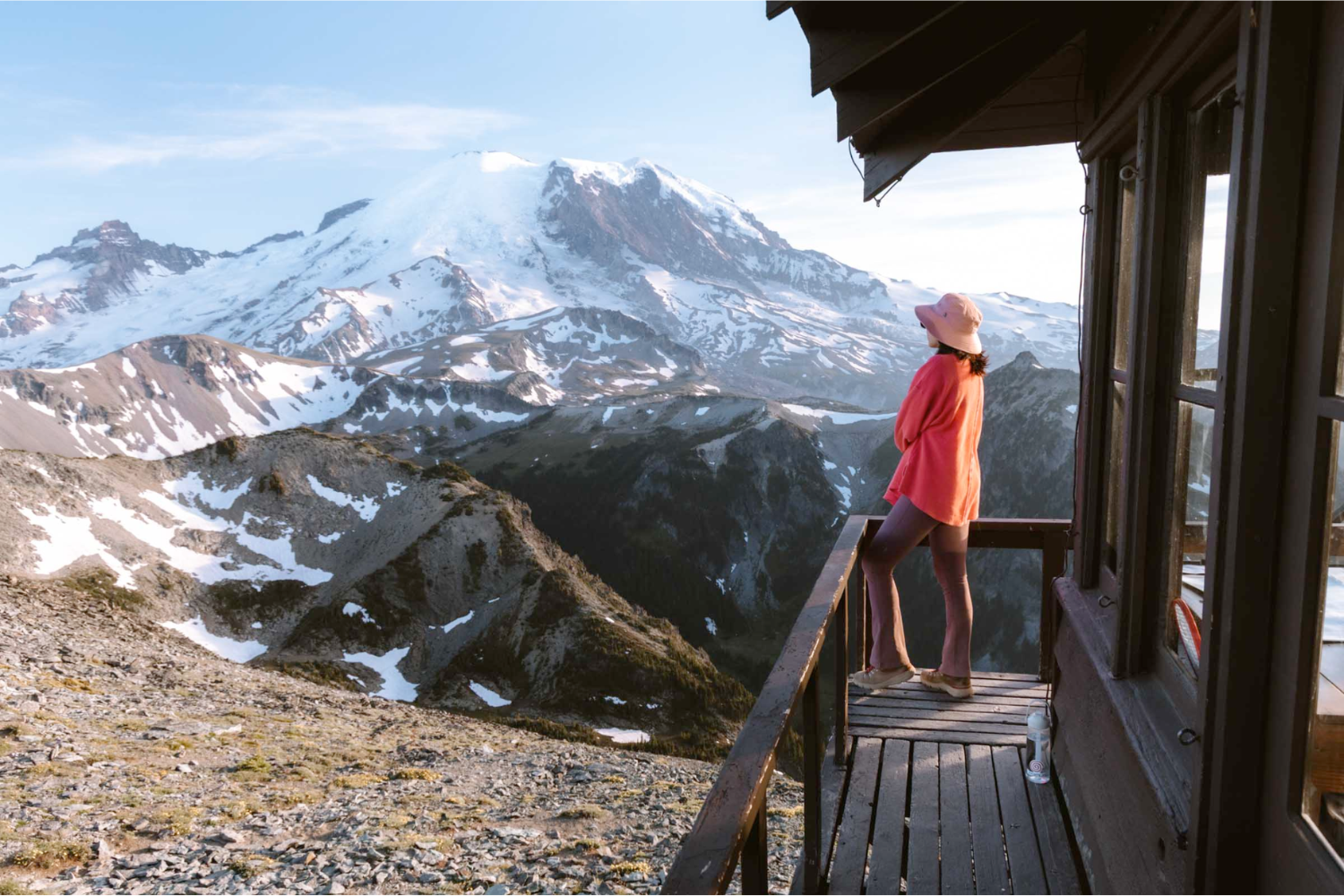
Mount Fremont Lookout
Hike to a historic fire lookout offering incredible views of Mount Rainier and the surrounding Cascade Range.
Along the way, you may also spot wildlife such as mountain goats or marmots.
The out-and-back trail is approximately 5.5 miles and gains around 1,250 feet in elevation.
Difficulty: Moderately challenging
Trail of the Shadows
Located in the Longmire area, Trail of the Shadows is a pleasant, mostly flat 0.7-mile loop through old-growth forest and meadow.
It’s an excellent option for visitors looking for a short, easy walk rather than a strenuous mountain hike.
Difficulty: Easy
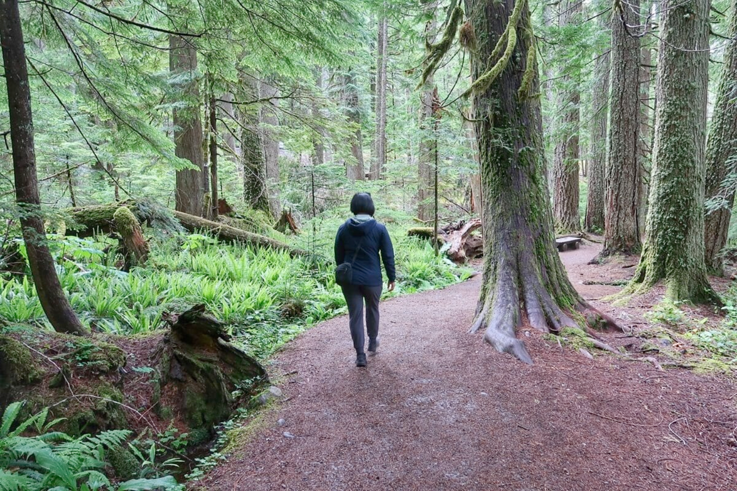
Rampart Ridge
Also located near Longmire, Rampart Ridge is a 4.6-mile loop that climbs up, across, and back down the ridge.
The trail gains approximately 1,400 feet and offers views toward Mount Rainier, the surrounding forest, and the Longmire area below.
Difficulty: Moderate
Easy Hikes Within Seattle City Limits
Looking to stay in the city? We’ve got trails for that.
Seattle offers numerous public parks featuring miles of walking and hiking trails, many accessible by a short drive, rideshare, or public transportation.
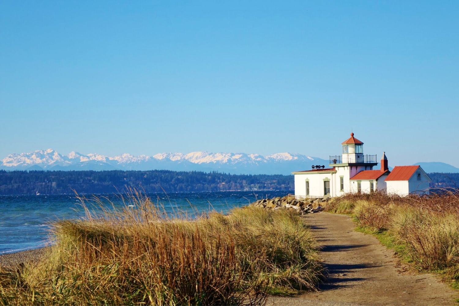
Discovery Park Loop
At more than 500 acres, Discovery Park is Seattle’s largest public park.
The 2.8-mile Discovery Park Loop passes through forests and meadows while offering views of Puget Sound and the surrounding mountains. Visitors can also explore areas near West Point Lighthouse.
Parking: Free parking within the park
Difficulty: Easy
Washington Park Arboretum Loop
A botanical gem northeast of downtown Seattle, the Washington Park Arboretum is another great option for an easy day hike.
The 2.7-mile loop gains only about 200 feet in elevation and winds through evergreens and seasonal flora.
Parking: Free parking
Difficulty: Easy
What to Bring on a Day Hike Near Seattle
If you’re choosing one of the simpler hikes inside Seattle city limits, recommended gear includes sturdy shoes, sun and/or rain protection, snacks, and water—items you would normally bring on a long walk outside.
For mountain hikes, conditions and remoteness vary considerably. Weather can change quickly, and even popular trails may have limited cell service.
For these hikes, carrying the 10 Hiking Essentials is recommended.
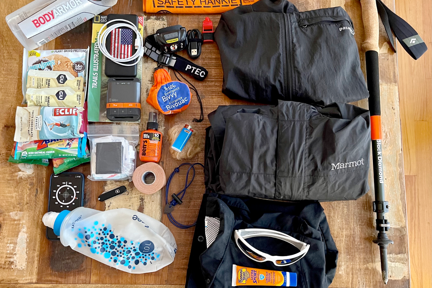
The 10 Hiking Essentials
1. Nutrition
Bring plenty of non-perishable, calorie-dense food such as trail mix or energy bars in case you’re on the trail longer than planned.
2. Hydration
Carry enough water for your route, weather conditions, and activity level. For longer or more remote hikes, consider carrying a portable water filter or purification tablets.
3. Navigation
Bring a topographic map, compass, and/or offline GPS navigation. If you’re relying on your phone, download your map ahead of time and begin with a fully charged battery.
4. Sun Protection
Pack sunglasses, broad-spectrum sunscreen, and a hat to help protect against sun exposure.
5. Extra Clothing
Bring an additional insulation layer, such as a fleece or puffy jacket, along with a rain shell to prepare for dropping temperatures or wet weather.
6. Illumination
Carry a headlamp or flashlight along with spare batteries. A headlamp is particularly useful because it keeps your hands free.
7. First-Aid Kit
Carry a basic first-aid kit with supplies such as blister treatment, bandages, gauze, tweezers, and any personal medications.
8. Fire
For remote hikes, consider carrying waterproof matches, a reliable lighter, and emergency fire-starting supplies. Always follow current fire restrictions.
9. Repair Kit & Tools
A multi-tool or pocket knife, duct tape, and basic gear-repair items can help with unexpected problems involving boots, backpacks, or other equipment.
10. Emergency Shelter
Carry a lightweight item that can protect you from the elements, such as an emergency bivy, space blanket, or other compact emergency shelter.
Find Your Next Day Hike Near Seattle
One of the best things about hiking around Seattle is the variety.
You can spend a morning walking through Discovery Park, climb to a viewpoint in the Cascade foothills, visit a waterfall near Snoqualmie Pass, or explore an alpine trail at Mount Rainier.
Whatever trail you choose, check current weather, road access, trail conditions, and parking requirements before leaving, and choose a route appropriate for your experience and fitness level.
And if you want to experience more of Washington without planning the transportation and logistics yourself, explore Tours Northwest’s Seattle tours and day trips.
Frequently Asked Questions About Day Hikes Near Seattle
What are some of the best day hikes near Seattle?
Popular options include Poo Poo Point, Mount Si, Rattlesnake Ledge, Mailbox Peak, Franklin Falls, Wallace Falls, and several trails within Mount Rainier National Park. For easier options within Seattle, consider Discovery Park or the Washington Park Arboretum.
What is an easy hike near Seattle?
Discovery Park and the Washington Park Arboretum are two easy options within the city. Franklin Falls and Trail of the Shadows are also relatively short compared with many of the mountain hikes on this list.
What are the best hikes near Seattle for views?
Poo Poo Point, Rattlesnake Ledge, Mount Pilchuck, Skyline Trail, and Mount Fremont Lookout are all known for scenic viewpoints. Visibility depends heavily on weather and seasonal conditions.
Can you hike near Seattle without a car?
Yes. Seattle parks such as Discovery Park and the Washington Park Arboretum can be reached using local transportation options. Seasonal Trailhead Direct service may also provide access to selected hiking areas outside the city.
What should I bring on a day hike near Seattle?
For easy city hikes, bring sturdy footwear, water, snacks, and weather protection. For mountain hikes, carrying the 10 Essentials—including navigation, extra clothing, illumination, first aid, food, water, and emergency shelter—is recommended.
Do I need a parking pass for hikes near Seattle?
It depends on the trail. Some trailheads have free parking, while others may require a Discover Pass, Northwest Forest Pass, National Park entrance fee, or another recreation pass. Check the requirements for your specific hike before leaving.
What is the best time of year to hike near Seattle?
Lower-elevation trails may be accessible for much of the year, while many higher-elevation trails are most accessible during summer and early fall. Snow, weather, road closures, and other seasonal conditions can affect access.